New snacks on sale now for a limited time! Use code NEW for 15% off.
1862 map of London with bus and cab routes print
£25.00
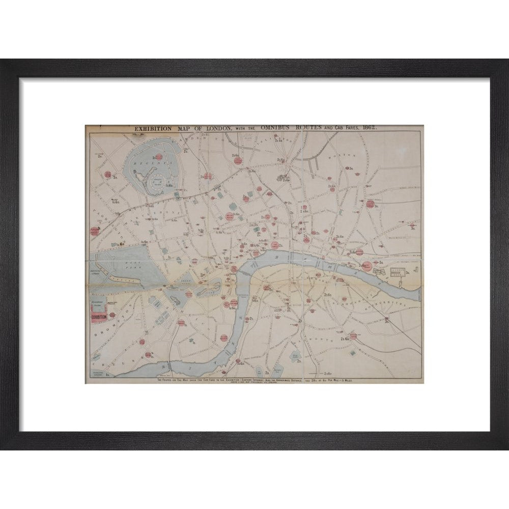
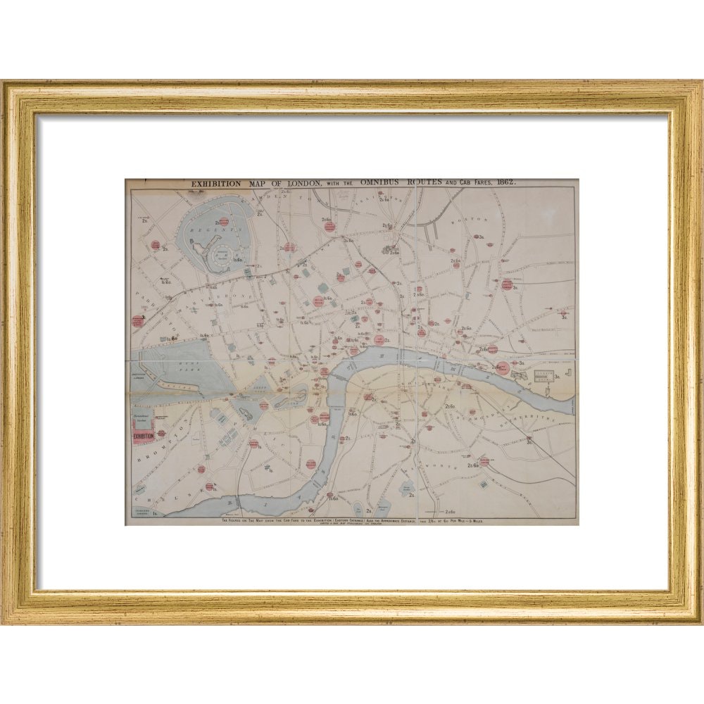
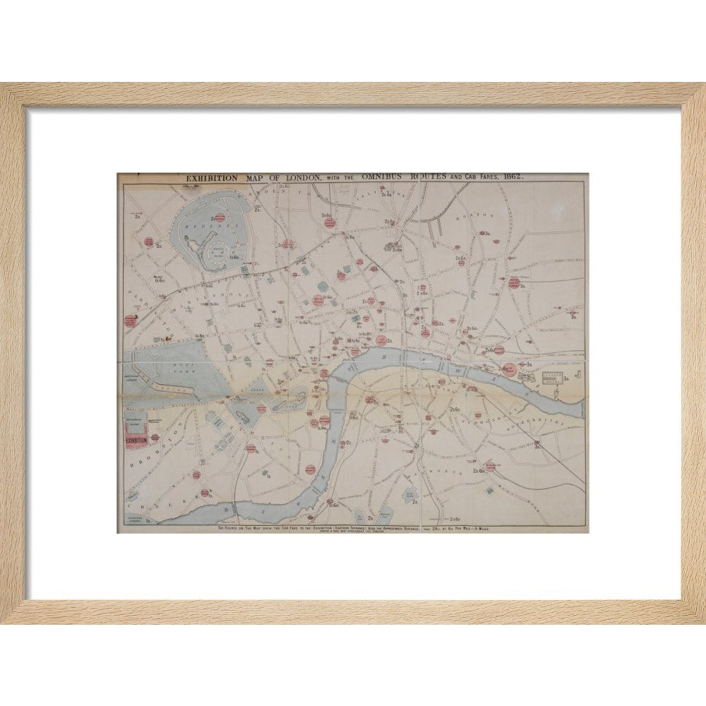
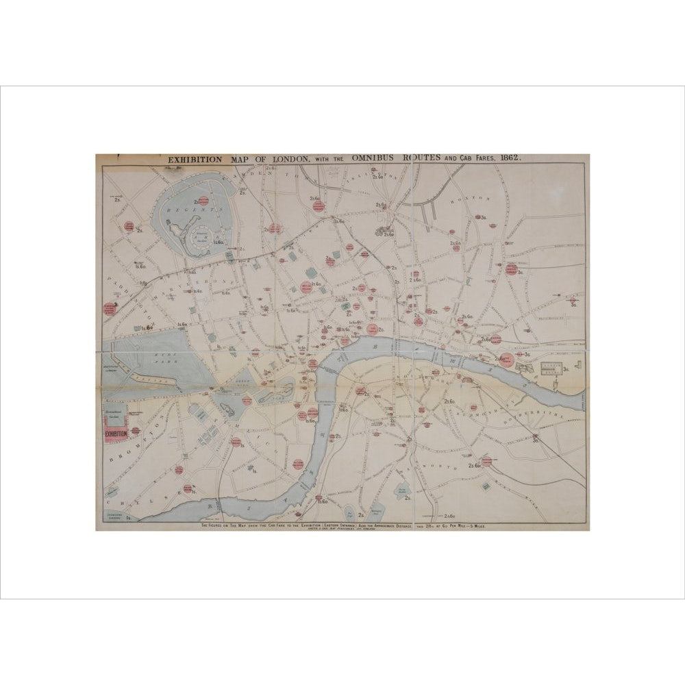
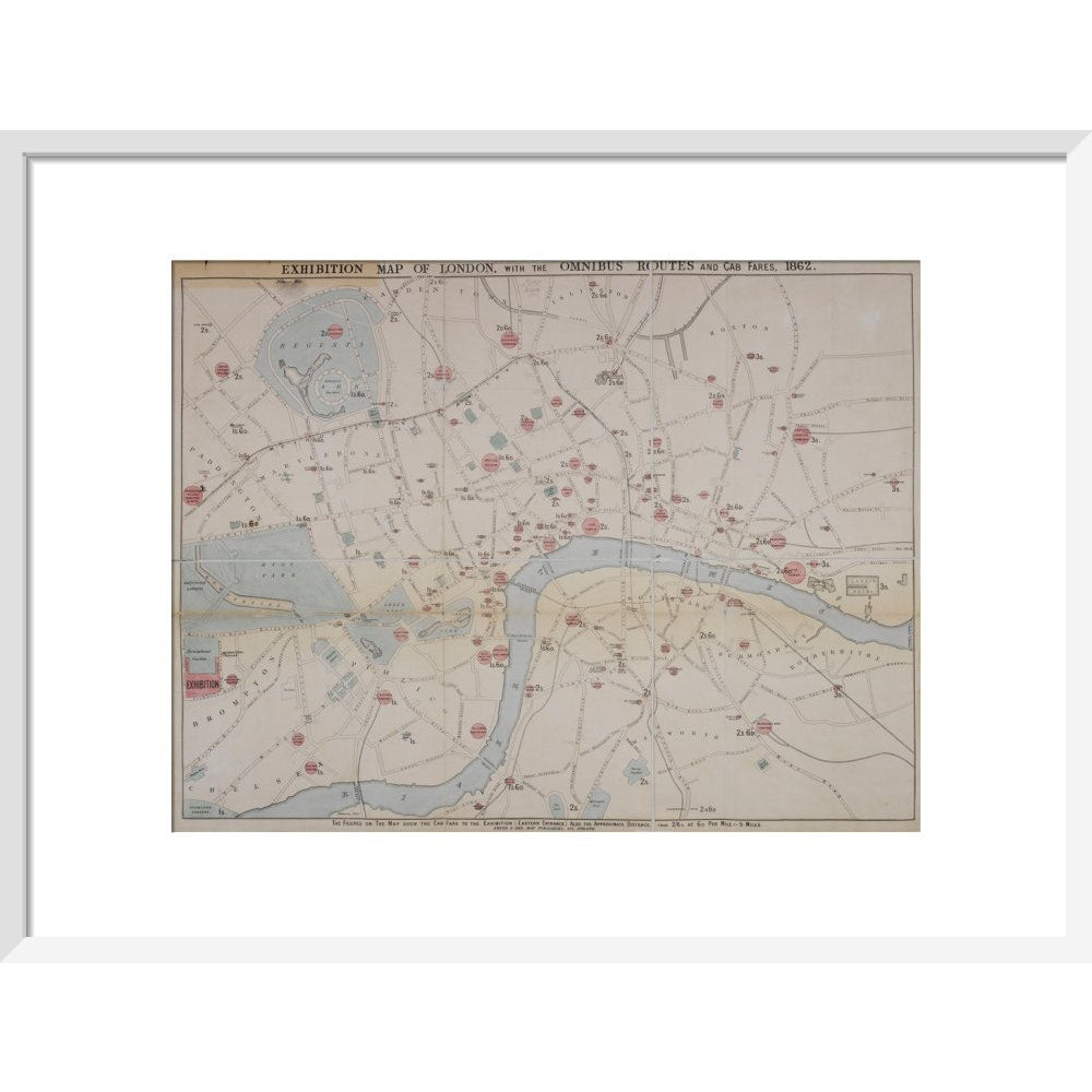
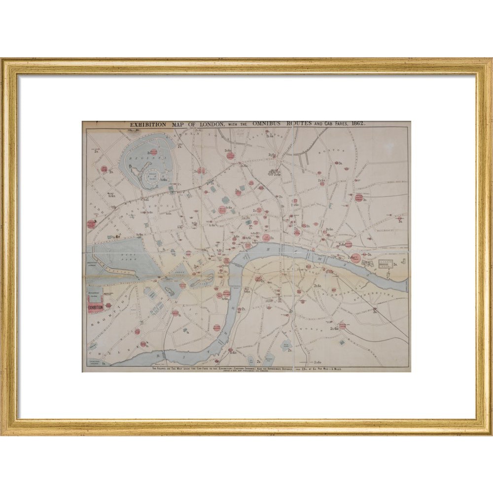
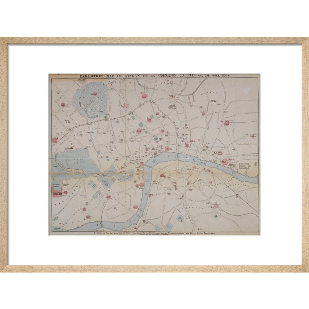
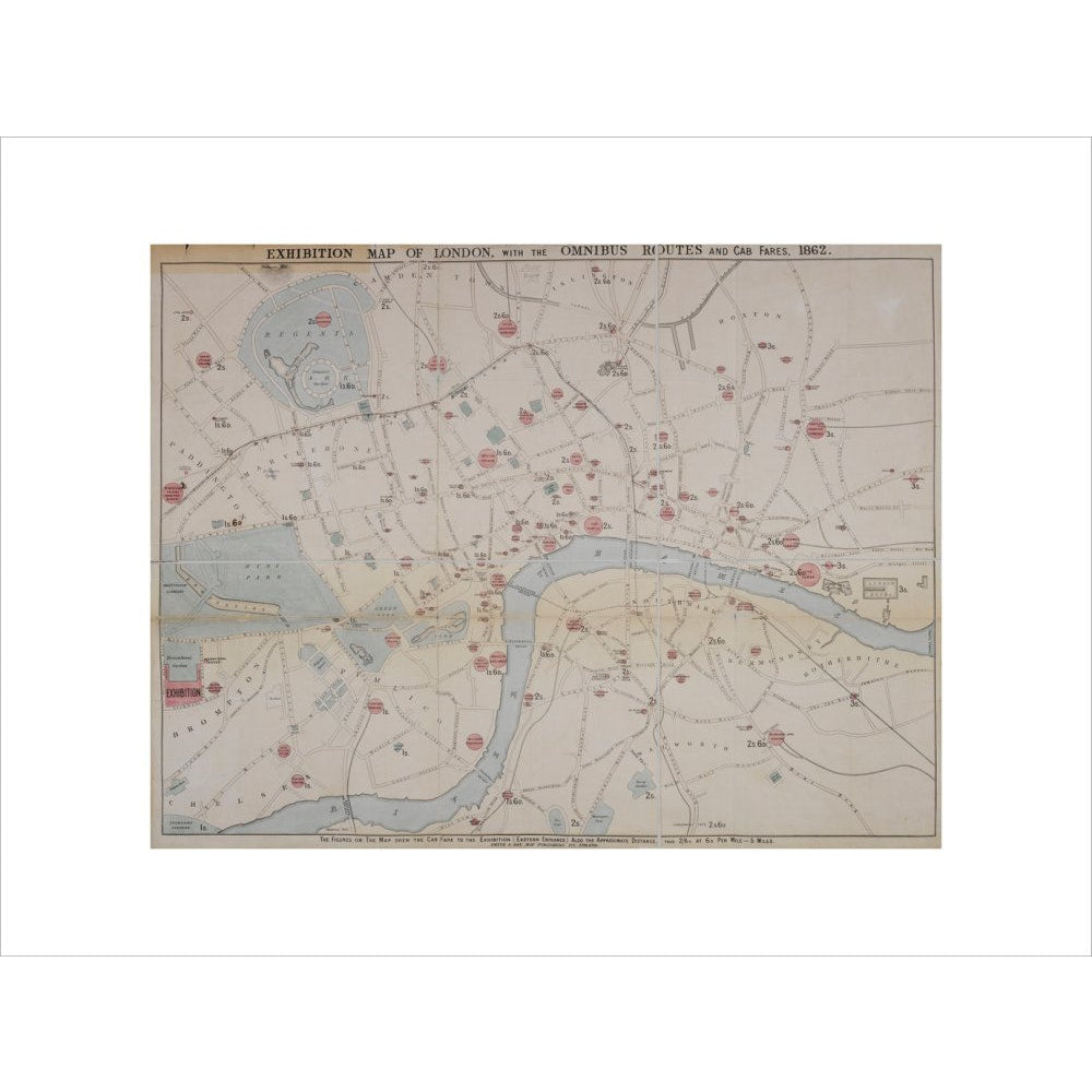
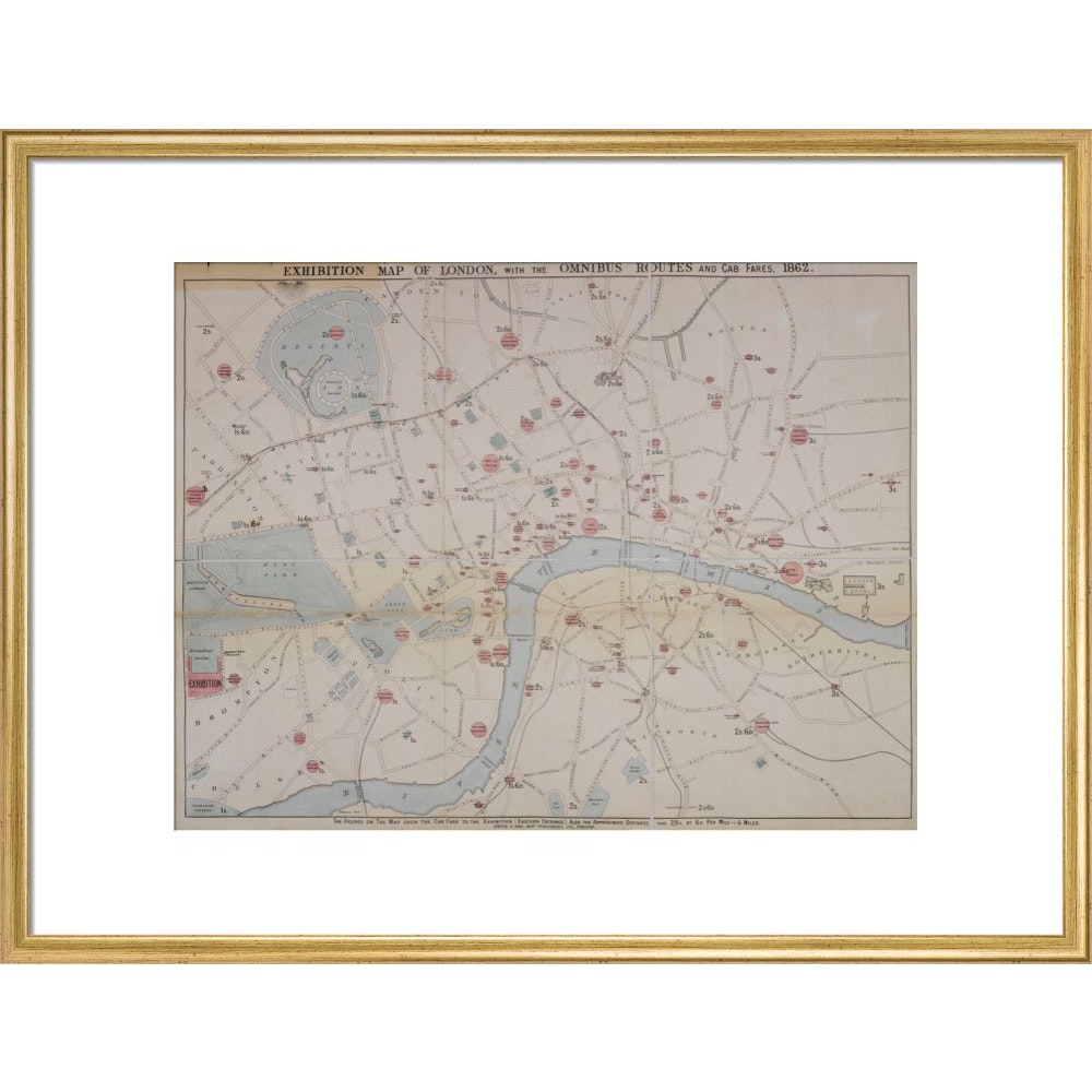
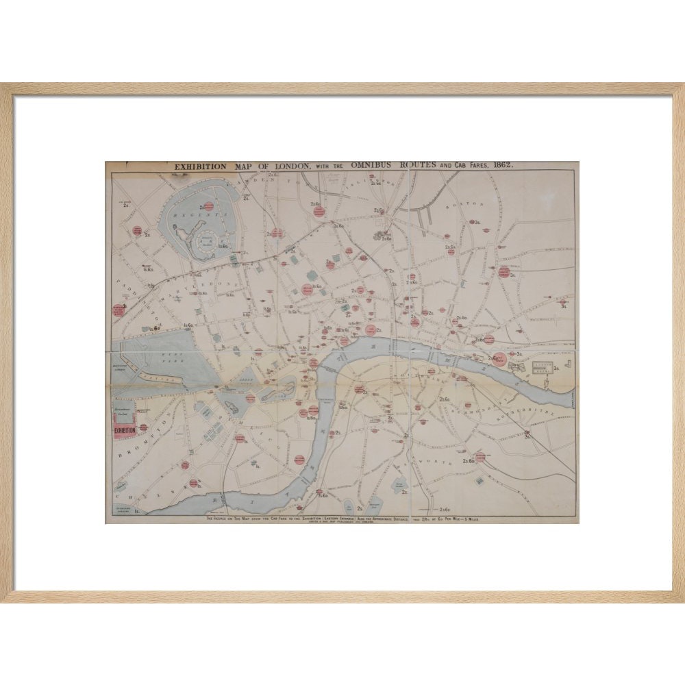
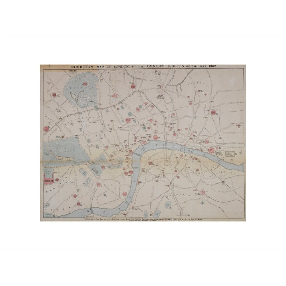
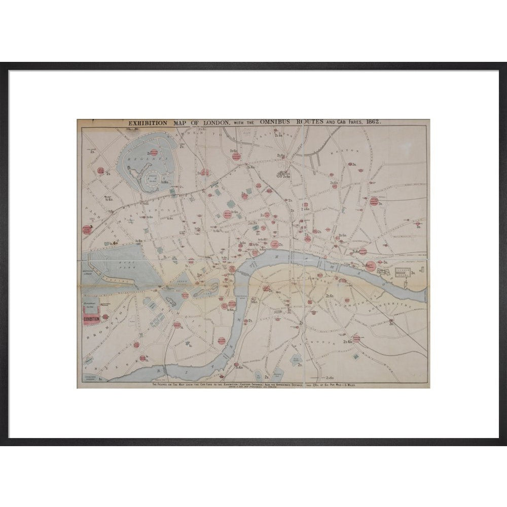
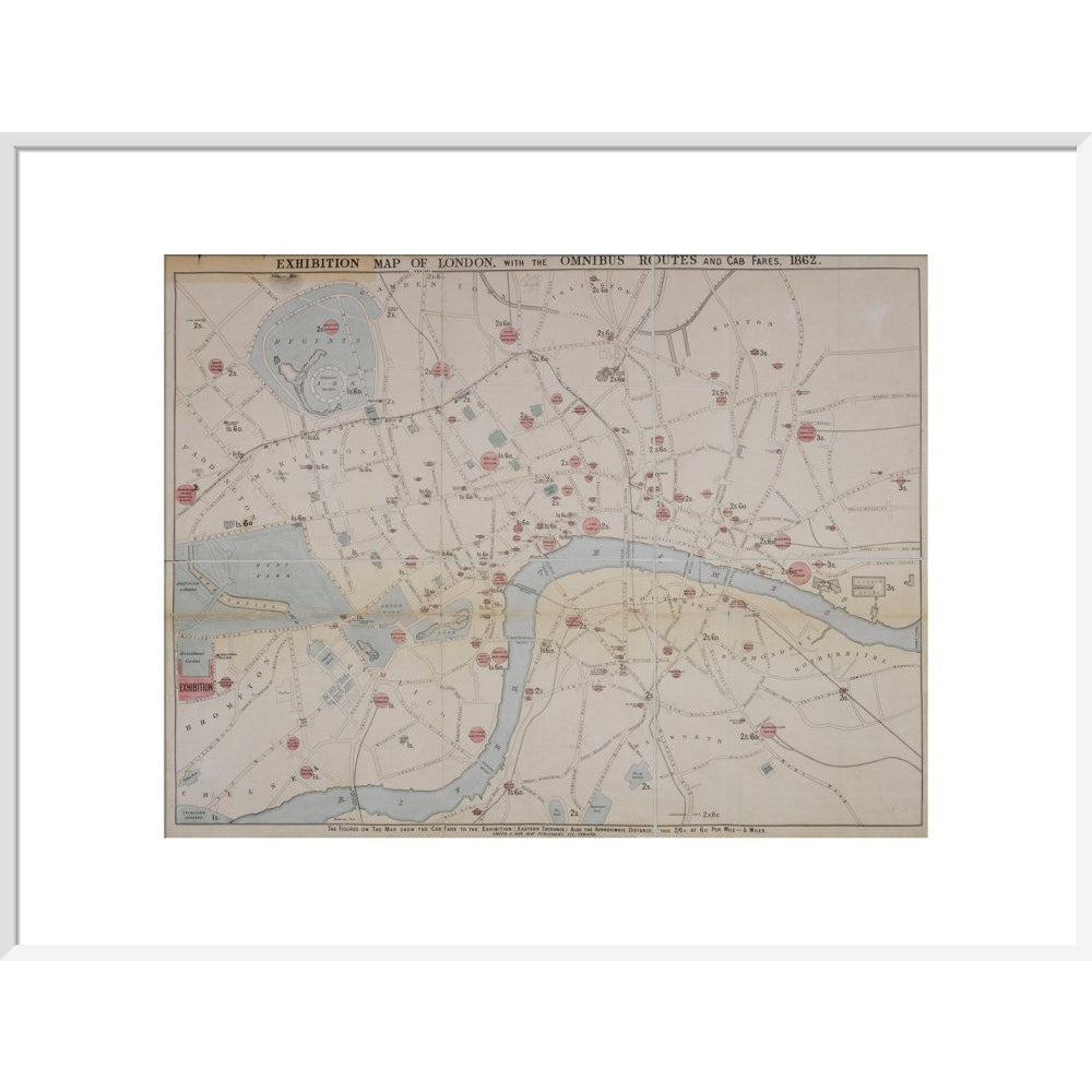
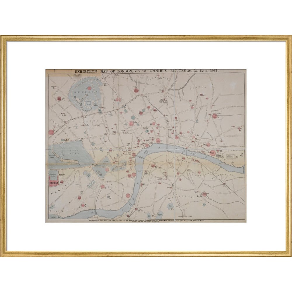
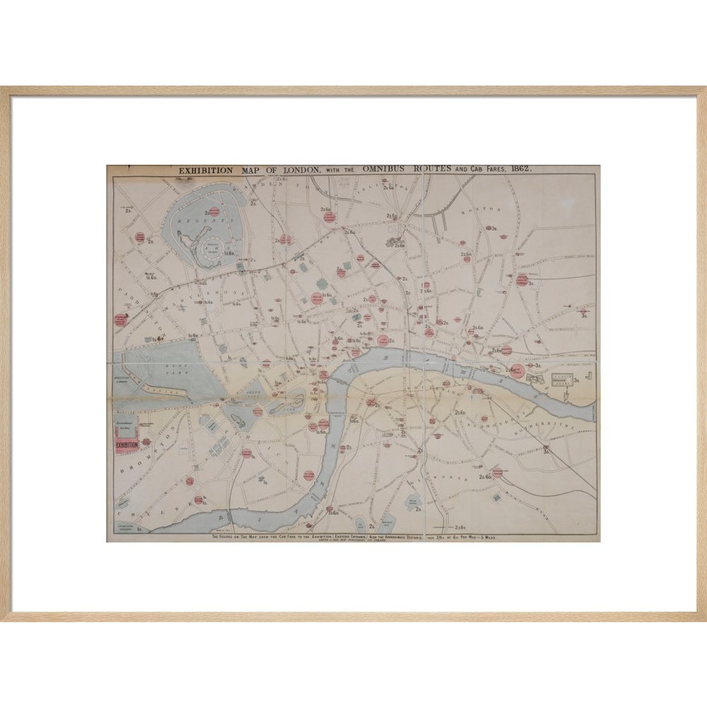
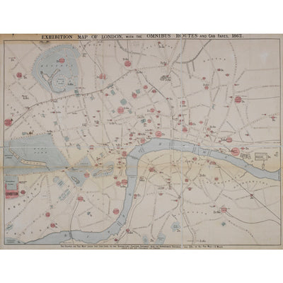
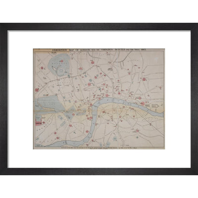
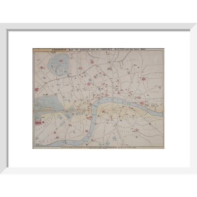
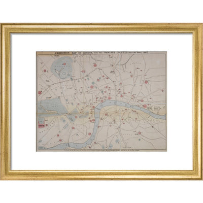
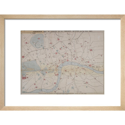
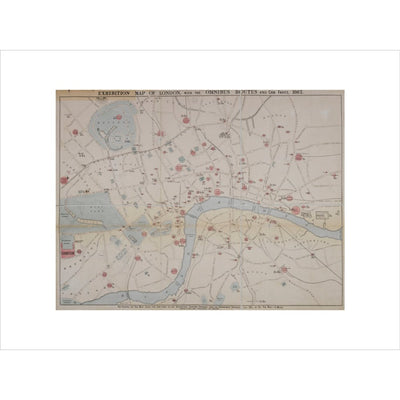
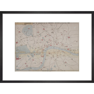
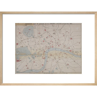
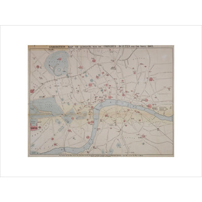
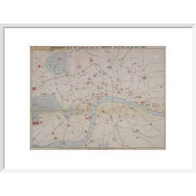
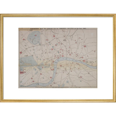
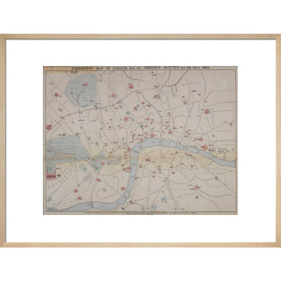
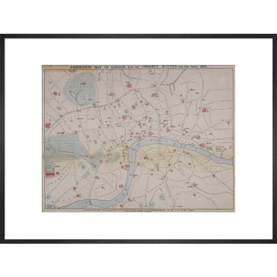
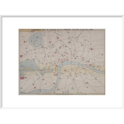
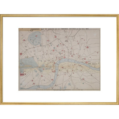
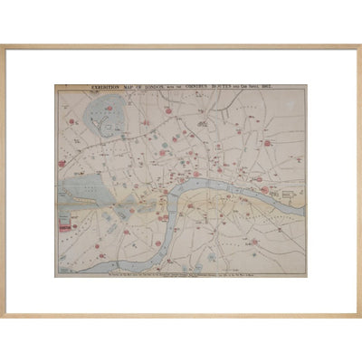
This 1862 map of London is entitled 'An exhibition map of London, with Omnibus routes and cab fares, 1862'. It covers London from Regent's Park in the north to the Oval at Vauxhall in the South, and Kensington Gardens in the West. to the London Docks and Thames Tunnel in the East. Other locations marked include the British Museum, Lambeth Palace, Bethlehem Hospital, Victoria Theatre, Covent Gardens, National Gallery, London University, M. Tussaud's exhibition, Custom House and St Paul's Cathedral. The text along the bottom of the maps reads: The figures on the map shew the cab fare to the exhibition (Eastern entrance) also the approximate distance, thus 2/6 D. at 6D. per mile = 5 miles. The map was produced by Smith & Son, map publishers. Maps.3485.(21.)
Reviews
You may also like
We use cookies on our website to give you the best shopping experience. By using this site, you agree to its use of cookies.