FREE UK Shipping on orders over £75 | Every purchase supports the British Library


£25.00
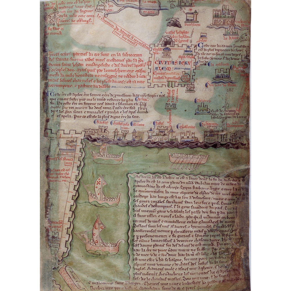
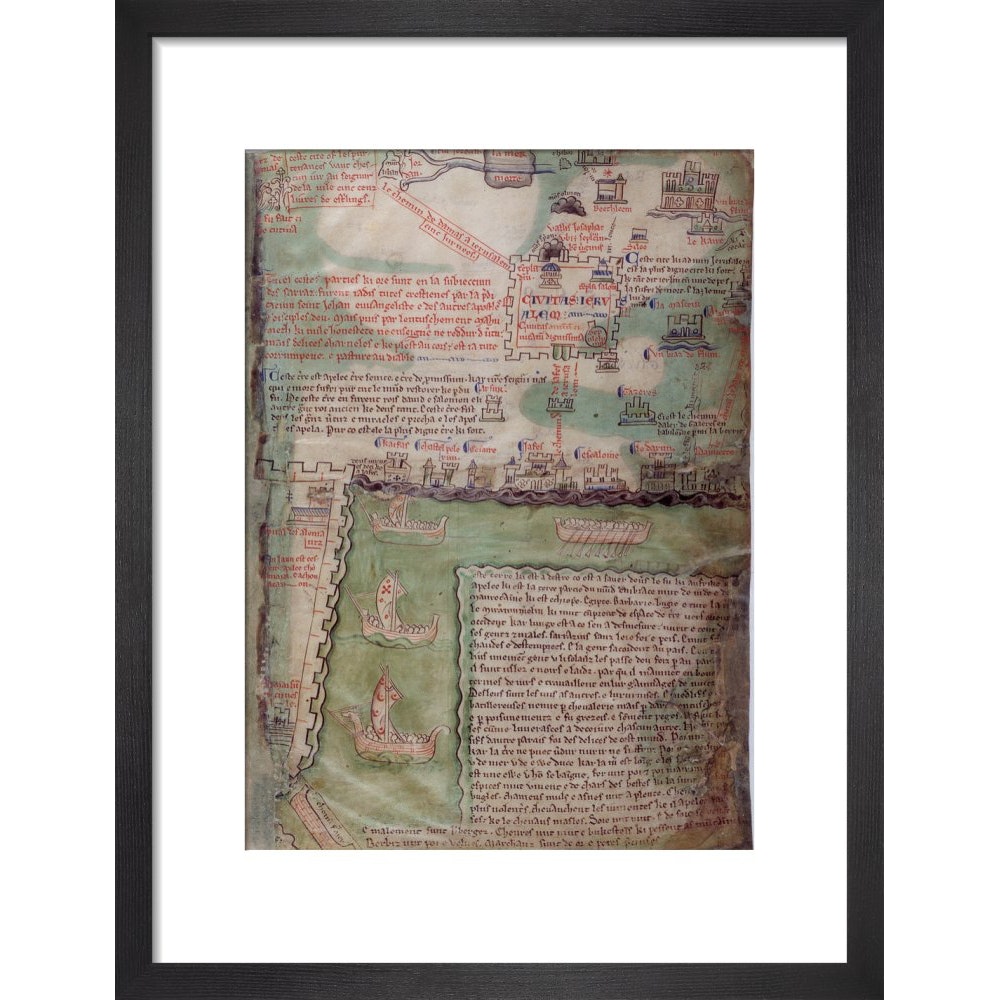
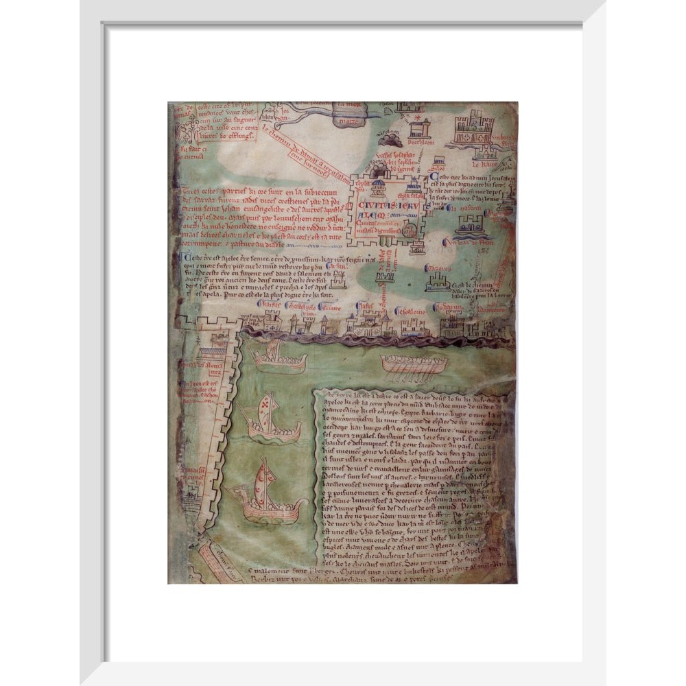
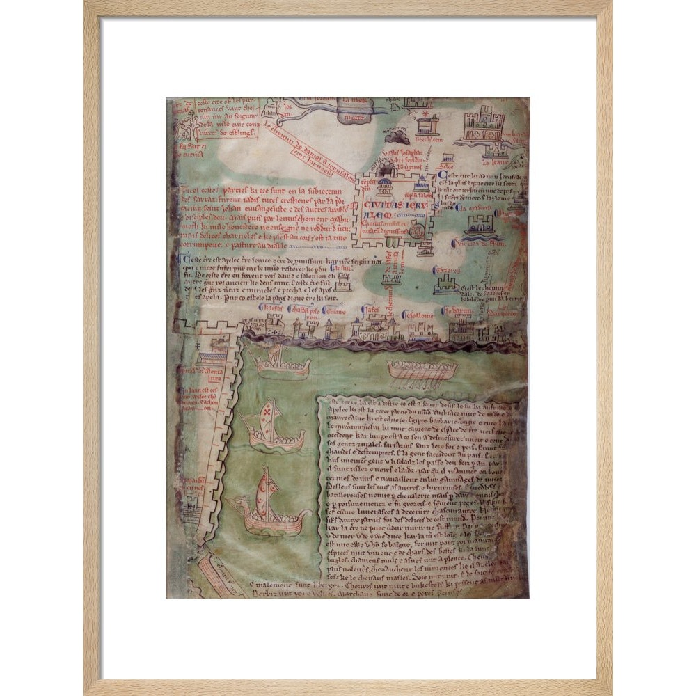
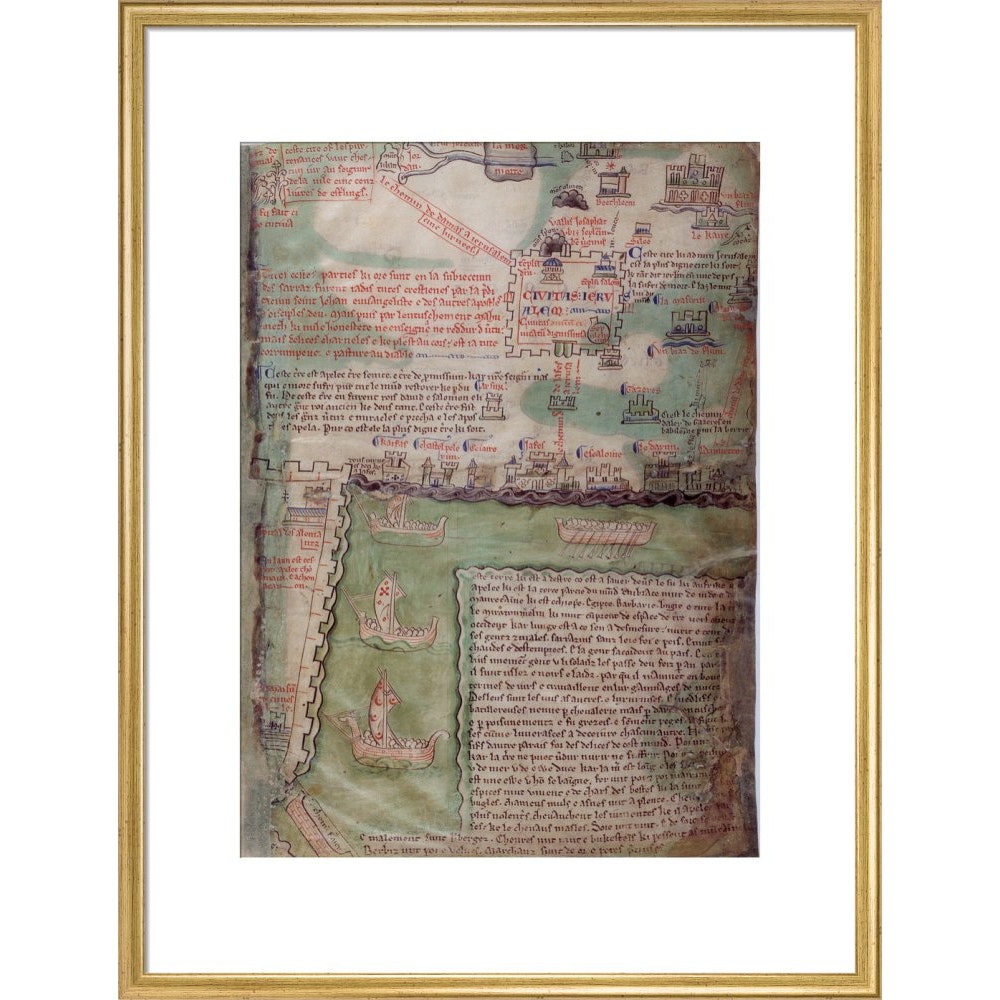
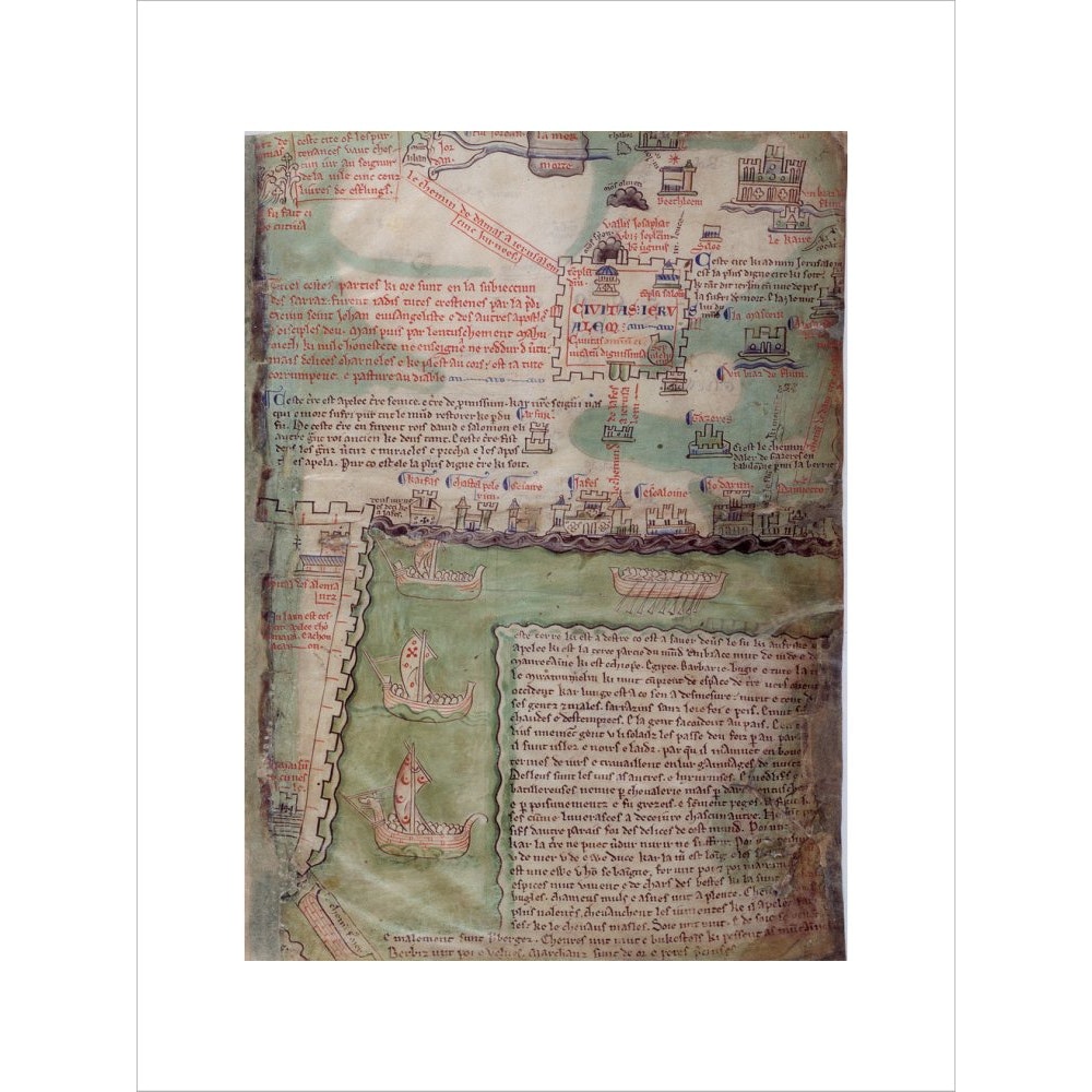
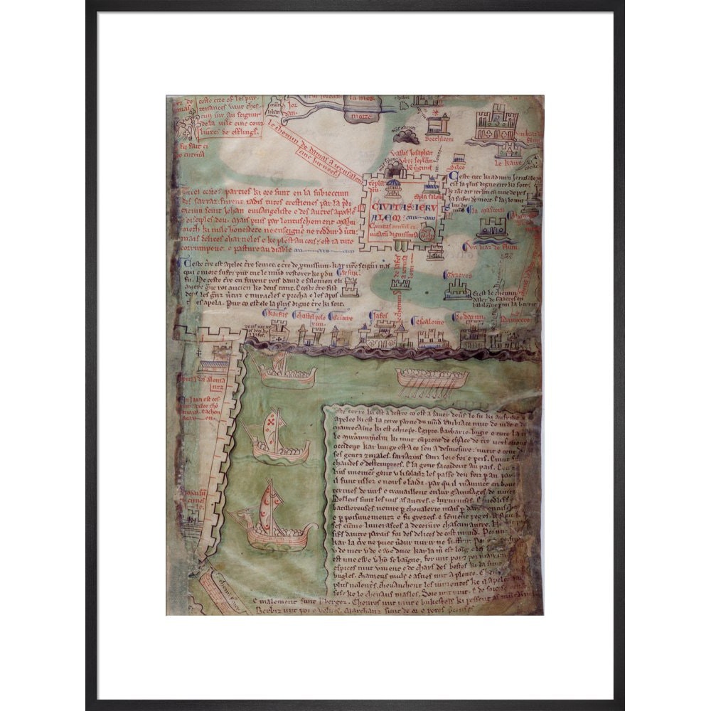
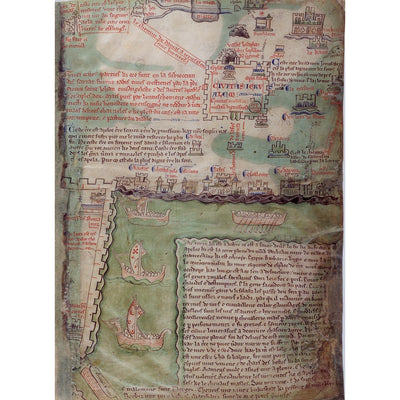
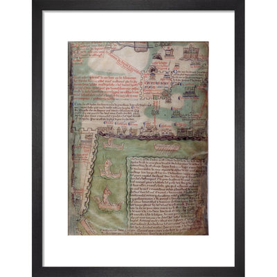
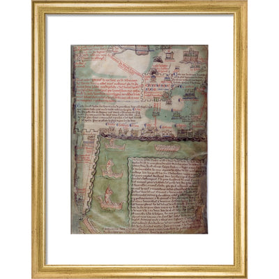
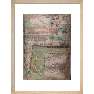
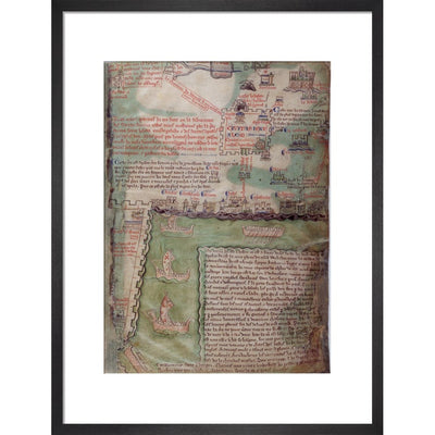
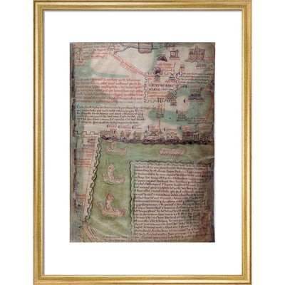
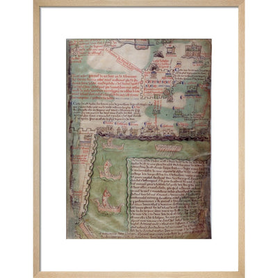
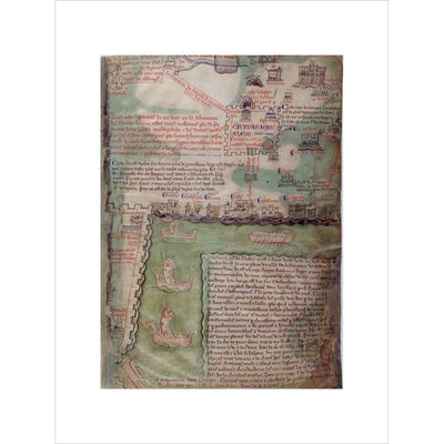
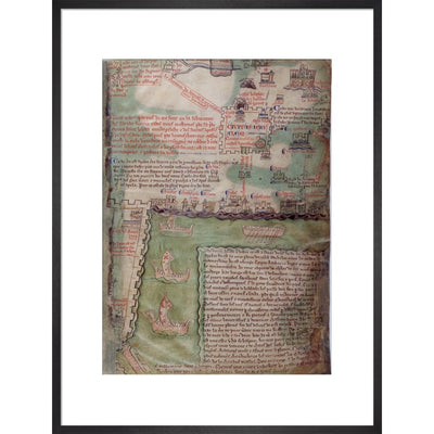
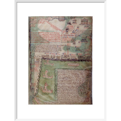
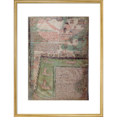
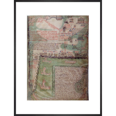
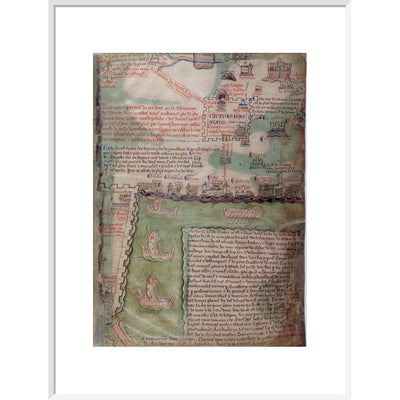
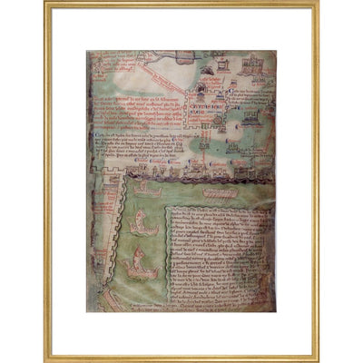
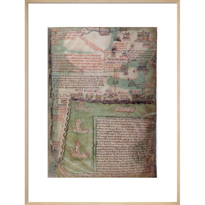
This section of the mid-13th century Acre map by Matthew Paris shows Jerusalem in the top right corner, with two temples, and the edge of the city of Acre can be seen in the lower left half of the map. Above Jerusalem, Bethlehem is depicted, as is the lower part of Nazareth. Royal MS 14 C.vii, f.5r.
Creator: Matthew Paris